If the history of the Indian Ocean Coast of Tanzania could have been video recorded with time lapse photography from the beginning of this millennium it would show an extraordinary pattern of visitors arriving, departing and settling on its shores. This coast has attracted sailors, merchants, adventurers, explorers and migrating tribes for thousands of years, and Arabic, Portuguese and European settlers have built and abandoned their commercial capitals here depending on the longevity of their control.
For today’s travellers, just the nature of the land is often treasure enough, and they discover a coastline of clean coral sand beaches as white and soft as riceflour shaded by palm trees and lapped by shimmering blue-green waves of the Indian Ocean.
A string of different historic towns slumber in this idyllic setting, often as a curious and crumbling reminder of a once more prosperous past. The individual towns of Tanga and Pangani, Bagamoyo and Kilwa all provide a range of options for accommodation and opportunities to enjoy the bright pace of Swahili coastal life in unusual and often magnificent surroundings.
From here you might arrange to discover nearby coastal game reserves or make underwater explorations into the world of coral reefs, or explore natural lagoons, islets and sandbanks on the wide and peaceful deck of a traditional old dhow.
The history of this Indian Ocean coastline is one of many centuries of sea-trading commerce and trade links to great civilisations such as the Egyptians, the Sumerians and Phoenicians and the Roman and Islamic Empires, who relied on overseas trade for wealth and acquisition of luxury goods and raw materials.
It is thought that this East African coastline, known as Azania, formed a part of international trade relationships for more than 2000 years, although the earlier millennium is harder to verify with historical accounts. However it is certain that trading connections were well established by the first or second century AD, as recorded in the Periplus of the Erythraean Sea, a guide to the trade and ports of Arabia, East Africa, India and their connections with China, written in the first century.
It is thought that some merchants settled along the coast, marrying and intermingling with local people during these early days, but these newcomers barely affected the cultural, social or political sensibilities of the day until the birth and growth of the Islamic religion and empire in the early centuries AD.
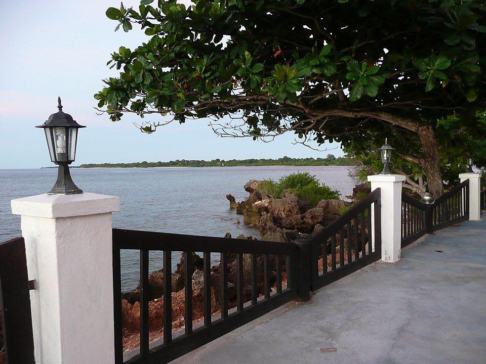
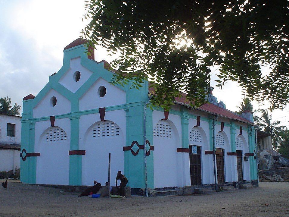
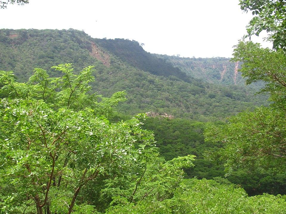
Matwara, Tanzania. By Michel Sautel – VonTasha – Own work, CC BY 3.0
Arab Immigration
The greatest immigration to the East African coast from the Arabian Peninsula occurred as a result of great religious and political upheavals after the death of the prophet Mohamed between the 8th to 10th centuries AD. Large numbers of families then emigrated to settle along the Azanian coast, which they called the ‘Land of Zanj’, and they founded settlements that developed into powerful thriving centres of Islamic culture.
An adventurous sailor and Arab writer called Abu’l Hasan’Ali Al-Mas’udi recorded an account of his travels to Zanj at the end of the 10th century AD. He describes the ‘villages of Zanj’ stretching for ‘700 parsangs’, equivalent to 2,500 miles, which would cover the distance from the Red Sea to a point on the mainland opposite Southern Madagascar.
This coast became a focal point for Indian Ocean trade, the land to which the monsoon winds blew from the Arabian lands in the East. Their wooden dhows would sail the ocean laden with textiles, hatchets, daggers, awls and types of glass, as well as wine and sometimes wheat. They would set sail when the winds changed direction to take them home laden with cargoes of gold, tortoiseshell, ambergris or crammed with African people bought from the trading ports and taken as slaves.
So this land of plenty earned an attractive reputation around the Arabian Gulf, and when political and religious strife made life hard in the Persian Gulf and Southern Arabia, many were inspired to leave their homeland and rebuild their communities in the sunny and palm-fringed land of Zanj.
The Sultan legend
Legend tells how many of the settlements along the Tanzanian coast grew from one spectacular emigration led by Ali bin Sultan Hasan of ‘Shiraz’, the capital of Fars in then Persia, now Iran. Some stories tell how in 975AD he had a dream that a rat with iron jaws was gnawing though the foundations of his palace. He interpreted the dream to be a threat to the very foundations of his family and rule, and resolved to move them all away to somewhere safer. This would also have coincided with the religious and political upheavals synonymous with the growth of the Islaam.
The Sultan then organised himself and each of his six sons and their entourage into seven separate boats, and they all set sail for Zanj on the monsoon winds. Somewhere in the midst of the Indian Ocean they were separated by a storm which caused each dhow to land at different points along the coast and islands, including Mafia, Kilwa, Pemba, Tongoni (Tanga), and the Comoros.
This coincides with tales of the Shirazi Sultan of Kilwa, who arrived in the islands of Zanj and bought Kilwa Kisiwani for a length of cloth, and then sent his son, Bashat to the Mafia Archipelago to govern his sultanate there.
The story of Ali bin Sultan Hasan was a good tale for newcomers to ensure their welcome as the descendants of a valiant and wise Shirazi king, but the likelihood of its validity is slim. It is more likely that during the 9th and 10th centuries AD émigrés from the Arabian Gulf first settled further north on the Azania coast, in the present-day land of Somalia, and then moved south to finally settle along the coast of present day Tanzania between the twelfth and fourteenth.
Many of these settlements achieved prosperity resulting from Indian Ocean trade, and then suffered an often devastating decline following the arrival of the Portuguese in the 17th century.
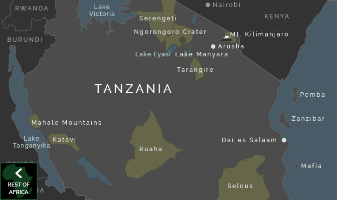
Map of The South Coast of Tanzania Lindi, Mikindani and Mtwara
Lindi, Tanzania
The small town of Lindi is an uneventful and quietly dusty port town that makes a welcome stop if you have approached it in a southerly direction on the long hot road from Kilwa.
There is little to immediately indicate its once more glorious past, now just discernible by its scattering of unusual and diverse ruins among the overall grid of dusty low-level housing and shop fronts, but there is an overall atmosphere of self-sufficiency and quiet industry that give the town a curiously dignified atmosphere, despite its fall in fortunes during the 20th century.
The town has at least two large mosques and a fine Hindu temple at its centre, and overall a distinctly Asian and Arabic character, with many Indian merchants based here for their port of trade.
There are a few restaurants in its main street providing options for some good food and there are a handful of alternatives for cheap and decent budget accommodation.
The surrounding natural areas include clear beaches to the north of town and nearby areas of rainforest such as the Litipo Forest Reserve near Rutamba village, both of which are worthwhile excursions.
Lindi was first settled during the 18th century by Omani Arabs, who left a legacy of a number of carved door lintels and an old stone tower on the harbour front that was once used as a prison to stand as witness to their once powerful era today.
The port then became an important and bustling centre of the slave trading caravan route between Lake Nyasa and Kilwa Kivinje when it fell under the jurisdiction of the Sultan of Zanzibar in the 19th century, and during this time the clock tower was built, now standing at the town centre near the market.
Then it was central seaport for Lake Nyasa (Lake Malawi) and later, during the German era, Lindi was made the administrative centre of the entire Southern Province, and developed the coast to include a custom house and store house for the German East Africa Company.
The dilapidated and overgrown Boma north of the Arab tower overlooking the sea and immaculate parallel line town planning remains evidence of the German era. Seafront benches and ancient old hotels suggest that Lindi was once a popular resort for hot expatriate farmers to spend time at the coast in a degree of comfort. But the town was abandoned during the years of the British protectorate in favour of the deep natural port town of Mtwara and then their intended scheme for making a fortune from groundnut crops proved an absolute disaster.
Injury was added to dismal fortune when the town then suffered cyclone damage in the 1950s.
What to do in Lindi
There is little of specific interest around Lindi town centre to provide adrenaline inspiring entertainment, but a walk up the seafront and into the market is a pleasant diversion and will reveal most of the landmarks mentioned above.
The best beach in Lindi is Mtema beach, about 5km north of the town centre, and it is possible to take a ferry from the port at the end of Amani Street to the village across the bay, where it also possible to stay in good, cheap accommodation.
Another good excursion that is worth taking as an overnight is to Litipo Forest Reserve, some distance out of town, near the village of Rutamba. This last remaining patch of rainforest is a wonderfully peaceful and natural area, with a couple of small lakes to either side and quiet forested region at the centre, alive with hundreds of birds.
Buses leave twice each morning from Lindi town centre, and take around 3 hours, travelling at an average speed of just over 10km per hour.
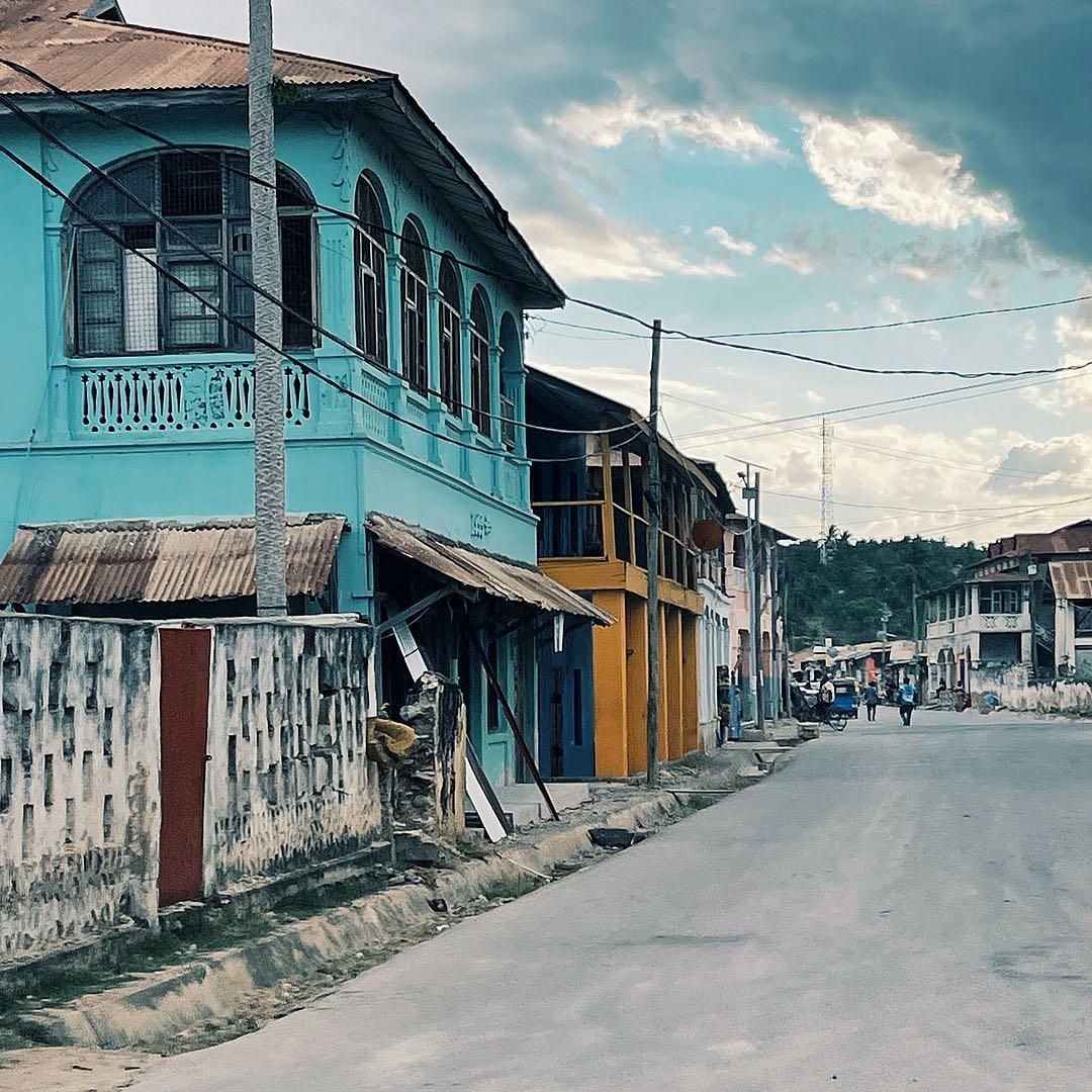
Mikindani, Tanzania
It is an extraordinary experience to arrive at Mikindani at the end of a long, bumpy and extremely dusty drive from Kilwa or Dar es Salaam.
After mile upon mile of rural distances with often no sign of human habitation, (with exception to the rows of shops and restaurants in the efficient but rather characterless town of Lindi), the final bend in the road that reveals Mikindani town can seem to be a fairytale encounter.
Nestling between mountains and sea on a large circular natural lagoon, this tiny town has the historic atmosphere of quiet quaint that attracts visitors to tiny villages in the English Cotwolds or Italian hilltops in Umbria.
Old Slave Market in Mikindani, Tanzania. By Vincent van Zeijst – Own work, CC BY-SA 3.0
The winding streets are flanked with a hotchpotch combination of thatch and mud, or stone work with balconies and carved wooden doors from the Arabic and colonial days. It is not as ancient as Kilwa Kisiwani, and was never as important as Bagamoyo, and it has experienced a similar sudden downfall of fortune that changed it from a thriving port town to a quiet backwater almost overnight.
But over the years Mikindani has received small doses of much-needed nurture that have kept the profile and character of the town distinct.
History of Mikindani
As with most of the port towns along the coast Mikindani suffered a succession of rising and falling fortunes with the turning tides of trade. Its perfectly protected bay provided naturally sheltered anchorage and it was the closest seaport for trade caravans coming from Lake Nyasa, and from Zimbabwe, Zambia and present day Congo.
Arab trade and settlement at Mikindani is thought to extend from the 9th century through to mid-19th, evidenced by some remains of ruined mosques and graves, although there was previously a settlement of Makonde from Mozambique at Mvita, to the north west aspect of the lagoon where some interesting tombs with carved plaster decorations with porcelain bowls inset can still be seen.
By the late 15th century trade from Mikindani was traced through Zambia and Malawi as far as Zaire and Angola. Ivory, tortoiseshell, animal skins and copper were exported and manufactured goods such as clothes and weaponry were brought in. Demand for the export goods lapsed in the early 16th century with the disruptive activities of the Portuguese all along the coast, but picked up again in the middle of that century when the whole coastal region came under the jurisdiction of the sultan of Zanzibar, and slave trading became better business.
But trade continued to fluctuate until the next boost in business occurred around the 1850s, when Arab trading peaked once more and this little southern town became a major trading centre. If you were to arrive in Mikindani at this time, two centuries ago, you would have encountered a busy port town settlement over a spectacular ocean lagoon.
Things to Do in Mikindani
Most of Mikindani town as it stands today dates from the mid-19th and early 20th centuries after it regained prominence as a trading centre for Arab dhows purchasing ivory and slaves. Many of the ruins seen in the old town were homes or trading posts of these first foreign traders distinguished by their carved doorways and flat roofs, while wealthier merchants built themselves two storey houses with intricate balconies above their shop front below.
Mikindani then came to the attention of the Europeans towards the end of the 19th century when Dr David Livingstone recorded his stay here early in 1866 before embarking on his final expedition inland, and just a couple of decades later the town became subject to German Colonial rule. Livingstone’s double storey house with superbly carved wooden doorways was renovated by the ministry of antiquities in 1981, when a commemorative plaque was added and an unprepossessing corrugated iron roof.
The Germans made Mikindani the District HQ, and constructed a number of impressive two storey coral rag houses with fretwork balconies on the upper level, and some of their more elaborate constructions have recently been subject to extensive restoration work.
The old German Boma sits high on the hillside overlooking the town and bay with 1895, the date of its completion, inscribed over the door. It was designed as fortress, (‘boma’ is the swahili for fort), but included an administration office and an officers’ residence and mess that included the luxury of a tennis court on the Eastern side.
Mikindani Bay as seen from the Old Boma Hotel, Tanzania. By Vincent van Zeijst – Own work, CC BY-SA 3.0
It later became a police station, but was abandoned during the 1960s and fell into disrepair. The Boma has recently undergone extensive and stunning restoration at the hands of an interesting new charity called Trade Aid, who are working to develop the local potential for eco-tourism in Mikindani.
The German colonial government also renovated and rebuilt the old 19th century slave market with heavy classically styled coral columns and looping open arches to convert it into a public market close to the waterfront to commemorate the slaves who were shipped from here. This has recently undergone a colourful restoration, also masterminded by Trade Aid, who have filled in the open arches and painted the exterior.
Nearby, the Old Prison on the waterfront (near the main bus stop) is in a very poor state of ruin after being bombarded in World War I and could do with some similar attention.
The first colonial government implemented large scale farming schemes for crops such as sisal, rubber, coconut and oilseed, but as business boomed and the trade ships grew larger it became necessary to build new deepwater port.
Or to opt for a cheaper alternative, and move the port 10km south to Mtwara, where there was already a naturally deep channel to support the trade. This fell into the hands of the British colonial government, when they envisaged even greater farming schemes, such as the infamous Groundnut Scheme (see below), and moved the district headquarters from Mikindani to Mtwara after the First World War, so sealing the economic fate of Mikindani.
Nowadays the families of Mikindani rely mainly on fishing and traditional dug out boats and dhows are used to bring home a subsistence catch. But this tiny town still harbours a few surprises, and a walk around its historic centre reveals a smart and well-maintained Hindu temple at the heart of this otherwise Muslim population, and a number of interestingly carved wooden doors and doorframes similar to the ‘Zanzibari’ style.
For a more modern addition to the town, find the ‘Hot Mik Bar’ a lively landscaped bar facing the bay beyond the mainroad, a good spot for all refreshments and a resoundingly popular satellite tv.
The story of Babu Banda and the German Treasure
The hillside behind the town is pleasantly wooded, and a not-too-steep track from behind the Old Boma leads up through sunlit glades to a superb viewpoint and the site of a rather unusual industrious task. This is the domain of Babu Banda, a stringently built local witch doctor who has been subjected to a number of instructive dreams by ancestral and Arab spirits.
The essence of these has been to tell him of German treasures buried at this summit behind the Boma, and for the past 8 months he has dogmatically undertaken the task of unearthing them. As he works his figure casts long shadows against the carefully dug wall of a crater-like hole about six metres deep, with just a thin bridge of solid earth running around the circumference before dropping off into a second previously abandoned crater beyond.
He tells how seven treasure seekers had been here previously, but were plagued with dreams of an Arab instructing them to leave and finally frightened off or killed by a huge snake. Babu Banda also has dreams of the Arab, but is instead informed to dig seven paces from the biggest baobab tree, and he employs magic to keep the snake away. His treasure so far includes an immaculate bronze ½ kilogram weight, and he claims to have discovered a cache of guns, but has decided not to dig deeper around that site in case of disturbing unexploded arms.
His dedication to unearthing the wealth of his dreams is impressively revealed when his simple spade is set to rest beside the cavernous depths he has carved into this red earth hillside. Meanwhile his family perch against the skyline, cooking ugali and sheltering under the snaking branches of the precariously rooted trees with the family rooster happily ensconced on Babu Banda’s wife’s head.
They have promised that when they find the treasure the rooster come to know the cooking pot.
Mtwara, Tanzania
Mtwara is a delightful and unusual town awash with charisma and charm. The colonial influence in its conception is plainly evident with one glance along its wide main street, Tanu Road, where an orderly avenue of flame trees cast some shade on the pavements and neatly frame a whitewashed church tower at the nether end.
Wide streets and vibrantly painted buildings, now known as ‘maduka makubwa’, ‘the big shops’ off Uhuru Road date from the days of the British protectorate and form part of a pleasant town environment that is well maintained by the regional government.
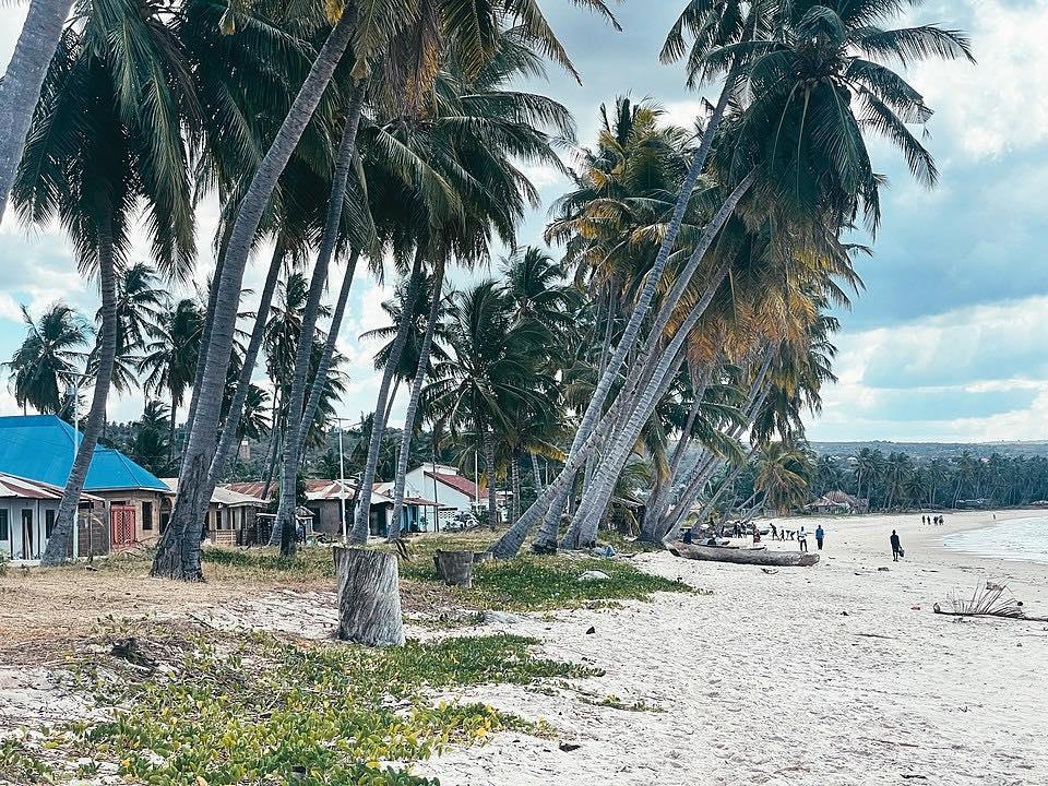
Schoolchildren were brought here during the 1940s and 50s to show them the effects of ‘modernity’, and Mtwara retains a pervasive pride and sense of independence despite the dire state of the surrounding infrastructure. Lack of tourists to this southern corner means there are pristine stretches of glorious beach and a fantastic number of coral reefs that have not previously been explored by anyone other than scientists.
The region also has a number of historical sites nearby and its proximity to the Makonde plateau provides opportunities to meet and watch Makonde carvers at work.
History of Mtwara
When the British Administration developed Mtwara Port after WWII they did so to accommodate the vast new trade ships they envisaged would be required for their infamous groundnut project, and had not yet discovered that their lack of planning for would soon cause them grand-scale embarrassment.
The ‘groundnut scheme’ was conceived to replenish the shortage of edible oils after the war, and implemented in a grand style near Mtwara in Nachingwea as well as Kongwa north of Morogoro and Urambo near Tabora. Although this was enforced with generous financial backing and modern farm equipment, they failed to carry out proper pilot tests to establish the soil and climatic suitability for groundnuts.
Crops were planted out over thousands of hectares but the expensive machinery imported to benefit from modern farming methods proved totally inefficient on hot African soil. Much of the work was finally carried out by hand and a total of £36.5 million was written off as a huge administrative farming error.
But perhaps the widely perceived folly of the British ‘groundnut scheme’ will finally prove to have been worthwhile if the deep water port at Mtwara is finally developed to sustain sizeable trade from Malawi, Zambia and Zimbabwe.
Mtwara port can presently handle a capacity of 700,000 tons of cargo, and although this is now sorely under utilised it could be increased to 1.5 million tons if plans come to fruition to develop the ‘Mtwara Corridor’ as a viable trade route. The local fishing trade, presently on a small-scale level, could also be increased to an industrial level.
The most popular export crop from Mtwara is presently cashew nuts, a cash crop whose fluctuating value on the world market makes for a fraught harvest time in late October, and recently there has been a reintroduction of oilseed crops such as castor which proved successful in this area when the groundnuts failed.
What to do and see in Mtwara: Around town
Mtwara is a pleasant town to hang out in, but with little intrinsic entertainment other than that which can be found by simply exploring the shopping potential.
The market forms a maze of shops and stalls around the bus station, with a number of local medicine men with stalls outside the main covered market with a wealth of lotions and potions to cure anything from impotence to unrequited love. The latter comes with a warning to be certain that the love harnessed is truly desired, as it is said to be so powerful that the recipient may resort to suicidal despair if their affection is not reciprocated.
A selection of Makonde carvings can be found for sale at a small hut on the side of Tanu Road, near the Catholic Church, or otherwise a much larger selection is exhibited for sale every Wednesday at the Benedictine St Paul’s Church east of the market in the Majengo area. This church is also well worth visiting on its own merit, to see its walls painted with an excellent collection of narrative paintings by Father Polycarp Uehlein. His vibrant biblical representations have a whimsical, dreamlike quality, perhaps influenced by Kandinsky, and form part of a larger collection in churches throughout Tanzania, including on in Dar es Salaam, although they greatest concentration is in the South.
The Shangani area has a relaxed sandy atmosphere, with a decent enough beach beyond the Finn Club for swimming after a hot day in town. The Finn Club itself is equipped with a table tennis table and small swimming pool in addition to a well-stocked bar and covered restaurant. They have changing rooms with showers if you are heading to the beach, and may be persuaded to keep an eye on your bicycles.
A man-powered ferry runs between Msangamkuu Peninsula and the dock in Mtwara Bay where fish is bought and sold, cooked or freshly caught at a shanty style bustling market on the beach. The sunsets from here are superb.
The peninsula is rural and sandy, with a local village and site of the Frontier Project camp. Sheltered areas can be found along its northern beaches for walking or swimming, whereas the view facing back to Mtwara port is frequently adorned with the bulky mass of vast cargo ships.
The town makes a good central location for exploring the surrounding area, with frequent local transport back and forth from Mikindani, and possible excursions to Msimbati, the Makonde Plateau and Mozambique. (see below).
Mtwara is the best base for making excursions into the region around and including the Makonde Plateau, which rises up to 900m above sea level and has become widely regarded as the Tanzanian base for the Makonde Tribe.
The Plateau remains an essentially rural area, made more difficult to explore as a result of extremely poor road connections. The best form of communication and local knowledge is through the local Anglican and Catholic church organisations, who have developed a wide and popular parish network here since the early 19th century.
But each of these towns somehow manages to thrive despite all the odds of their cut-off southerly situation, and there is great hope that the potential advent of the Mtwara Corridor trade route from Malawi will improve the local infrastructure here and provide even more opportunities for these impressively self-sufficient communities.
The Makonde Tribe
The Makonde are one of Tanzania’s most populous tribes, famous throughout East Africa for their distinctive ebony carvings. The tribe originated in Mozambique, where many still live, although as they have migrated and scattered the tribe has devolved into a multitude of separate villages governed by hereditary chiefs and elders.
Specific collective names have developed to refer to the situation of different Makonde, such as Makonde ‘by the sea’, or ‘of the plateau’, and sometimes ‘of the tattoos’ when referring to the Makonde remaining in Mozambique. The tribe traditionally made small scarring cuts on the faces of women at different stages of life in conjunction with the introduction of an ebony lip plug through their top lip.
Although some suggest that this was to dissuade slaves from stealing their womenfolk, it is likely that the tradition went back further, but the Makonde of Tanzania are fading it out altogether. Apart from forcing the top two teeth out of kilter, sometimes necessitating their removal, the practice is generally considered to hinder the Makonde girls seeking education and work in the new republic.
It is also widely held that the Makonde who have moved northwards into Tanzania are more progressive in terms of developing their carving styles and many have continued to move northwards from the Makonde Plateau in the Mtwara region of Tanzania to sell their carvings and work throughout the country.
The fundamental history of the Makonde tribe involves carving. It tells how originally there was one being, who was half-man and half-animal but remained neither. One day he took a piece of wood and carved a tall and wonderful sculpture, then set it outside his house that night as he slept. The next morning the sculpture had grown into a woman, and she was the first Makonde.
The tribe is traditionally matrilineal, meaning that Makonde women own any inheritances and children and men might move to a new wife’s family after marriage. All the tribal women are afforded great respect, whether they are old or young, or alive or dead, and have a wide reputation throughout Tanzania for their sexual expertise.
The family is a structural central unit, with housing built up in two concentric circles as it expands. Their carvings reflect their most important values, mainly following themes of ‘ujamaa’ meaning family, or ancestors, spirits and dreams. It is also more common to find Christian religious imagery now, especially around the Mtwara region, where many Makonde have converted.
Most Makonde Christians have chosen Roman Catholicism, and only a tiny number have converted to Islaam, although the larger proportion remain true to their traditional beliefs. Family sculptures are often represented by groups of abstract figures joined in a circular design, and ancestors may take a literal shape or otherwise be translated into very abstract spirit forms, which then moves into the popular realm of the dream carvings.
These are carvings inspired by powerful dreams, or sometimes cloud patterns and structures that suggest images. These will often evoke quite disturbing images of spirits called Sheteni, representing ancestors or evil spirits.
Makonde boys learn to carve properly around the age of ten, although they may have played with tools and wood before this time, and then later they decide whether their talent will lead them into figurative carving or to create domestic utilities such as bowls, plates, etc.
Newala
The first major town directly west of Mtwara is Newala, a remarkably upbeat and independent town considering its hopelessly remote location on the southern border with diabolical untarmacked roads in each direction.
The town is raised up on the hillsides overlooking the Ruvuma Valley, with impressive views south that seem to reach all the way to Mozambique. The road from Mtwara wends its way ever upwards through wild woodlands.
The slight altitude and wooded surroundings create a pleasant cool and breezy climate, with a propensity for clouds and mists. Local building in the centre of town is mainly concrete and stone, even with internal fireplaces and chimneys to keep out the cold.
It is worth making the trip out to the Shimu ya Munga, ‘Hole of God’, an impressively steep drop off the Ruvumu Valley side with views of the wild mountains beyond. More impressive natural surroundings can be well appreciated from the German Castle.
Masasi
Continuing west from Newala brings you to the the town of Masasi, the local district capital and another remarkably feisty southern centre for administration. Masasi sits at the end of the long tarmac road from Songea at the junction for the round route to the towns surrounding the Makonde Plateau.
It sits snugly surrounded by the Masasi Hills, with are good easy walking tracks to impressive outcrops of rocky granite kopjies and caves, one of which has rock paintings. The town developed from the Anglican Universities Mission to Central Africa settlement for freed slaves in the late 19th century, and it continues to thrive as an important missionary centre.
The foreign influence has given the town a reputation for being ‘kama Ulaya’, meaning like Europe, which can be taken more as an indication of the quantity of Western goods imported by the missionaries than as a real lifestyle comparison. The present President Benjamin Mkapa grew up in Masasi, and still has a house in town.
Hero Image: By Khalidsalewa – Own work, CC BY-SA 4.0